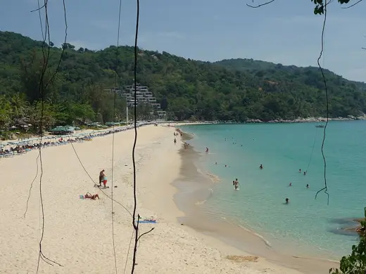
No licensed photograph yet for Nai Harn Beach
Overview
Nai Harn is a bay on Phuket's southwest tip, close to Laem Phromthep, with a freshwater lagoon behind it. Cafes and restaurants line the access road.
Facilities and access
| Public access | Open to the public |
|---|---|
| Access notes | Lies north of Laem Phromthep; a freshwater lagoon sits inland of the beach. |
| Getting there | Road access from Rawai; details not documented from an official source. |
| Food and drink | Yes |
| Lifeguard | Third-party guide: lifeguard towers operate in the monsoon months; no official confirmation. |
Not yet documented: Entry fee, Parking, Toilets, Showers, Changing rooms, Sunbeds and umbrellas, Dogs, Accessibility. A detail listed here is unknown, not absent.
Activities and planning
Surface: Not yet documented
Type: Coastal
Activities mentioned: Sunbathing, Swimming
Seasonal context for Thailand is organised by coast. See the Thailand season notes and pick the region closest to this beach; one town’s table is not a forecast for another.
Map
Coordinates 7.7763, 98.3057, taken from the cited source.
Nearby beaches
Sources and updates
Last compiled 2026-11-14. Found an error? Suggest a correction.
- Nai Harn Beach (Phuket provincial site) (authority)
Fact-level evidence
- location: North of Promthep Cape, about 3 km from Rawai and 18 km from Phuket Town; large freshwater lagoon inland source (2026-11-14)
- season: Calm Nov-Apr; strong rip currents possible May-Oct; red flags in monsoon (third-party) source (2026-11-14)
- food_drink: Thai restaurants and cafes along access road (third-party) source (2026-11-14)
- coordinates: 7.776339, 98.305677 source (2026-11-15)
Sources we could not reach
- phuket.go.th and tourismthailand.org returned HTTP 403; official content seen only via search summary
- No Wikipedia article fetched; coordinates and surface not sourced
- Lifeguard, toilets, fees unverified